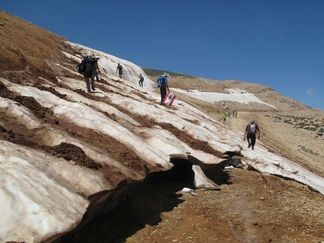
Qornet es-Sawda, the black peak, is located nine kilometers northeast of The Cedars and is the highest peak in the Middle East (3088 m). A hike to and from it - 12 kilometers each way - offers wide landscapes and stunning views and is a must do provided you are fit enough. Due to the snow season, the peak is only accessible from late April through early October. The best location to start your hike is from the car park of The Cedars ski resort lifts. From there, follow the path of the chair lift until after about two hours you reach the small hut at Fam al-Mizab (2800 m). From this hut, continue one hour north along the plateau while keeping to the left. To reach the actual top - another 300-meter ascent - climb for about one more hour. Going back the same way takes about three hours. If you do not feel like walking the whole trail, a possibility is to arrange a car to Dahr el-Qadib (between The Cedars and Oyoun Orghosh) or to organize a 4x4 to take you all the way just below the highest peak.
As there are no signs or indications, the best and safest way to hike to the peak is to arrange a local guide or to see whether you can join a trip organized by one of the local travel organizations, such as Vamos Todos, Sports4Life or Ski Lebanon. For contact details and more information, click here.